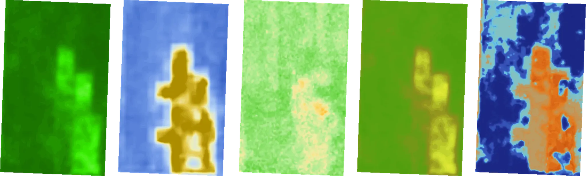
14以上の専門指標:作物の健康状態、水分ストレス、土地の潜在能力
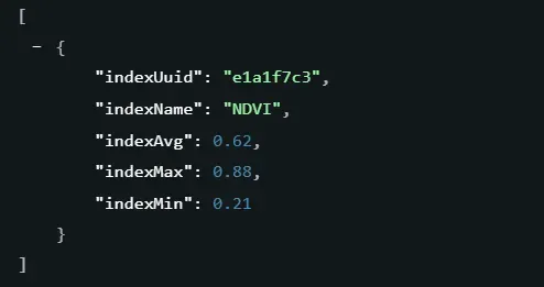
NDVI
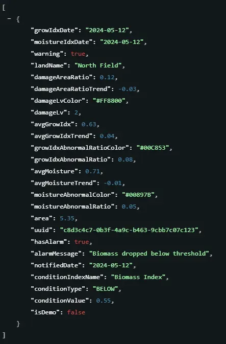
バイオマス指数
作物健康指数
作物窒素指数
作物の水分含有量指数
キャノピー指数
苗モニタリング指数
土壌水分指数
15cm深度の土壌水分 (%)
30cm深度の土壌水分 (%)
Soil Organic Carbon Index
水域指数
SOC at 15 cm depth (%)
Forest Stand Volume(m³/ha)
スケーラブルな単一のAPIで、グローバルな衛星データを実用的なインサイトに変換します。
複雑なシグナルを実行可能なデータに変換し、土地のモニタリングを自動化して推測を排除。
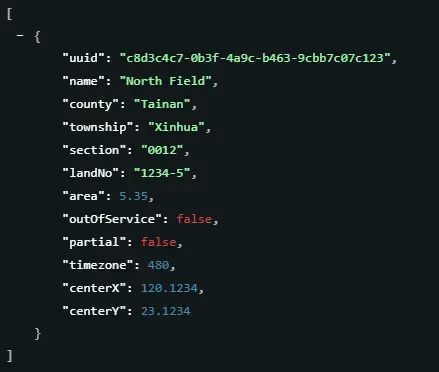
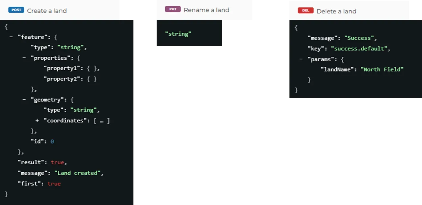
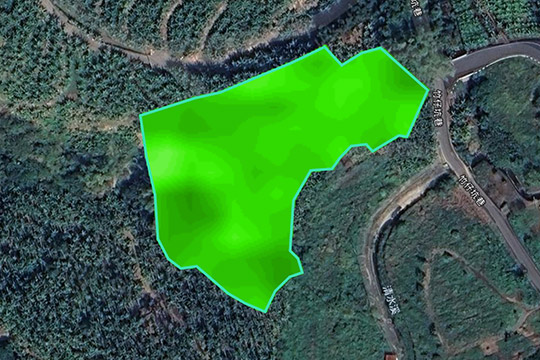
地理的境界を標準化されたデータ資産に変換し、GeoJSONのインポートからライフサイクル管理まですべてをサポートします。
観測頻度を分析可能なタイムラインと統計マトリックスに変換し、トレンド追跡と異常検出をサポートします。
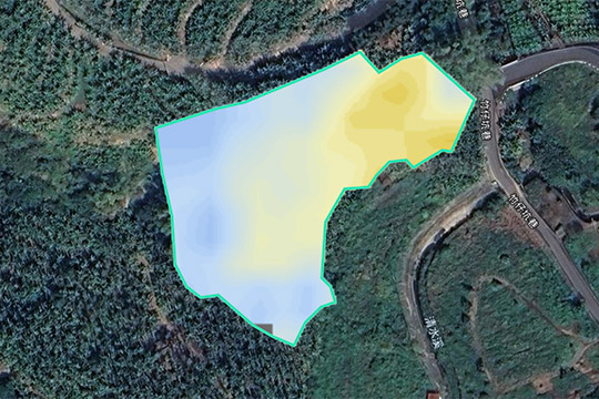
直感的な表示とプロフェッショナルな分析の両方に対応する1m x 1mのグリッド解像度にアクセスします。
異常をフィルタリングし、長期的なトレンドを追跡して、膨大なデータを時間に敏感なリスクインテリジェンスに変換します。
ノートの詳細、写真、および空間位置を含む、アカウントが所有する土地のすべてのFarmiTagアノテーション。
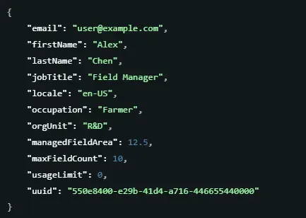
サブスクリプションとクォータを監視して、すべての組織メンバーの正確なデータアクセスを確保します。
安定したスケーラブルな環境のための標準化されたパラメータと同期します。
安全でシームレスな統合を確保するため、すべてのリクエストにAPIキーが必要です。テストキーをリクエストして、今日から土地管理体験の変革を始めましょう。